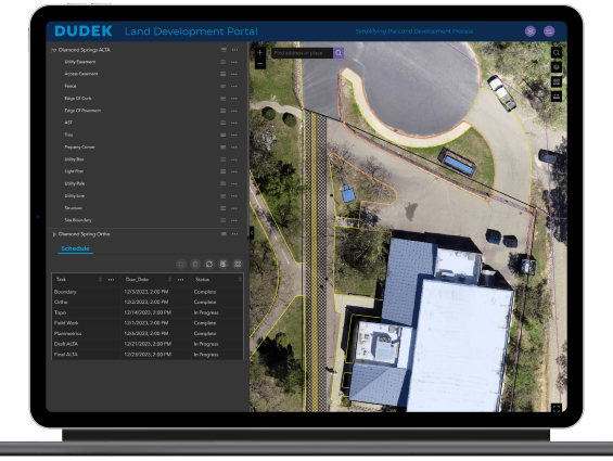
Mapping Portal
Dudek’s Mapping Portal, powered by Esri technology, provides instant access to project data as it is being created. Accessing drone mapping, GeoAI, GIS, CAD, and field data visualization in real time allows your entire project team to make informed decisions.
Features
- Real-time project survey data
- Daily project activity status updates
- Detailed field pictures
- Project deliverable database

Seamless Integration
Dudek’s Mapping Portal integrates directly with CAD, GIS, and other systems, providing a single map-based view of your project.
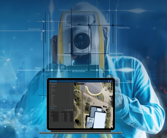
Live Project Schedule
Get daily updates from the field and project management team. With this information, you can confidently develop your projects knowing the real-time status of each key project task.
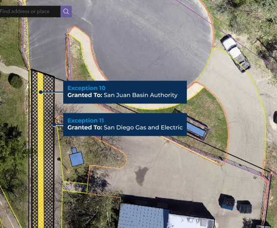
CAD and GIS Integration
Get access to ALTAs and Design CAD files as they are being created by your project team.
View easements, exceptions, boundaries, topo, and site mapping as it is being developed.

Streamlined Portfolio Management
Do you have several projects active at the same time? With the Mapping Portal, you have instant access to multiple ongoing projects within your company. Review project status and data for all projects at once.

Data Security and Autonomy
The Mapping Portal is built in Esri’s ArcGIS Online system, ensuring the highest levels of online security for all your deliverables. Your account is hosted by Esri, and you’re granted full control over the site.
Your data is never locked nor linked to Dudek, providing you flexibility and autonomy.

Increased ROI
Land management projects are dynamic with tight timelines. Having access to real-time data throughout the project improves efficiency and reduces overall project costs.
Storing all of your spatial data on a single site throughout the project lifecycle reduces the risk of data loss and eliminates the need to redo data files, which can be costly.
Why Dudek?
Dudek has an experienced team of licensed land surveyors, field surveyors, GIS analysts, and CAD technicians. As a celebrated 20-year Esri partner, we leverage industry-leading technology to provide you with innovative solutions that support informed and actionable decision-making.